|
|
| That's all my stuff right there |
Date: July 9 - 13, 2013
Where: Newfound Gap (GSMNP) to Max Patch (near Hot Springs, NC)
Weather: Pleasant to cool temperatures with mixed rain; sunny start then afternoon showers day 1, rain on day 2, clearing days 3 to 5.
Length: 47.3 miles
Elevation: Serious elevation changes: Newfound Gap, 5045; Mt. Kephart Trail, 6043; Guyout Spring Tail, 6330; Low Gap, 4247; Pigeon River Bridge, 1400; Snowbird Mountain, 4263; Deep Gap, 2929; Max Patch, 4629.
I had planned to hike this section back in April, but exited the trail at Newfound Gap (about half way through the Smokies) due to a minor knee injury and some trepidation about the rigorous and wild trail ahead. M and I planned a trip to see her mother and family in Asheville, NC, with the clear intention that she would take me back to Newfound Gap and I would finish the trek.
Day 1 (10.4 m): So on Monday we drove up there and she dropped me off under sunny skies with mixed clouds and a chance of afternoon thundershowers. I left the Gap around 9:00a headed for the Peck's Corner Shelter about 10 miles away. I was a little anxious because this would be the second time I had to go back a finish a planned hike and I did not finish my last one from Damascus. One would think that after 650 miles of backpacking the AT that I would have figured out what my limits were given the circumstances and planned accordingly. I am still learning. Once I ascended to the ridge, I basically stayed up most of the day. I pretty much stayed on a long ridge that is also the TN/NC border all the way to Max Patch. I felt good all day and rolled into the shelter about 2:30p with the last 30 minutes in a light rain. All my gear was fairly dry except my trail runners. The week prior the Smokies received a remarkable amount of rain. The area now had a year-to-date measurable rainfall that exceeded all of last year. Everything was wet and soggy, especially the trail and the abundant overhanging vegetation. Wet shoes and socks are a hikers nemesis and were part of the conspiracy that ended my Damascus hike prematurely. I know that my shoes are not likely to dry out anytime soon, since the humidity is so high and the trail will remain wet for days even without more rain (which is forecast). I spent a solitary afternoon and evening in the shelter with numerous thundershowers. I read, ate and slept and tried to avoid recognizing every sound in the bush as a bear or wild boar. Well appointed shelter: clean, level, benches, fireplace, good water and privy.

 |
| Typical piped spring |
Water management is an important aspect of long-distance hiking: one wants to stay properly hydrated but does not want to carry that heavy stuff (a pint is a pound the world around), so having a reliable trail guide (AWOL is best) that indicates all the water sources along the trail can help immeasurably. This spring was actually right on the trail, up near the top of the ridge; amazing how the water just pours out of the mountain. Someone took the initiative to jam a pipe into the source for easy use.
 |
| Shaded Trail |
 |
| Shaded Trail |
 |
| Sunny Trail |
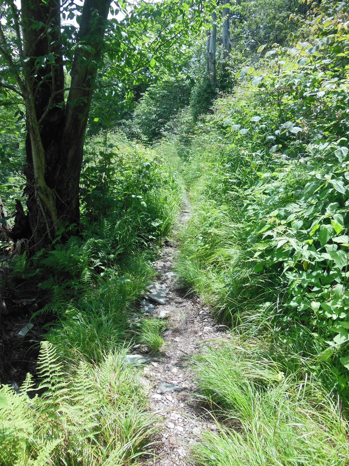
Where there is sunshine the vegetation teems, creating an overhanding wet tangle to walk through. Everything below the knees gets wet. I did use a new pair of gaiters that helped keep my socks and the top of my shoes drier but still the abundance of water was too much for my feet to stay dry.
 |
| Stormy? |
 |
| Stormy! |
 |
| Storm - see the rain on the left? |
 |
| Peck's Corner - lonely |
 |
| Cables and pulleys for storing food out of reach of bears |
Day 2 (12.9 m): After a good night's sleep I was out of the shelter by 8:00a having cooked breakfast and enjoyed some coffee. I had about 13 miles to the Cosby Knob Shelter and the day was looking foggy, damp, and stormy. The trail in many places was completely waterlogged and would suck the boots off of unwary hiker just plowing through. During the rain the trail became a stream itself and by the end of the day my shoes and socks were completely soaked. I had extra socks but even if I changed them they would become wet within minutes. I learned on my last hike that hiking in wet socks with my current trail runners would scare up abrasions on the top of my feet. By the time I reached a vacant Cosby Knob I knew I had some foot work to do. Otherwise my rain gear did well.
During a slight downhill I heard at first what I thought was a lightning strike, a sort of crack that alerted me to the impending storminess. But then I heard another crack and then multiple cracks and I realized that some part of a tree was in the process of breaking off or falling down. The sound intensified dramatically and compounded into a series of loud cracks and crashes that lasted for a good 10 to 15 seconds. After the crashing ended I concluded that a large tree or trees on the opposite slope from me must have fallen over and in the process of moving down the mountain slope taken out some other trees. I cannot remember ever hearing that much noise in the mountains and, of course, I was completely alone on the trail at this point. Did anyone else hear it or was that raw audio display of power (gravity) just for me? Afterward I just stood for a moment and listened to an almost silent environment save for a few twittering birds and the rustle of windblown leaves.
 |
| White Out |
 |
| Where do I step now? |
 |
| Morning break at Tri-Corner Knob Shelter |
 |
| Stairway to Heaven? |
I am learning more about videos and how to load them into a blog post. This one seems to be working fine but if it is not on your device, would you please let me know?
Cosby Knob Shelter: After spending the previous night alone I was delighted that folks start showing up at this shelter. By the end of the day seven people had joined me, several of whom I interacted with for the next couple of days. The first guy to show up had not been there very long before he turned to my and asked, "Are you Henry Micks?" Nonplussed initially I croaked out a yes while trying to figure out how in the world he knew who I was. Billy was a Ridge Runner, on staff with the ATC. His assignment this season was to hike the AT in the Smokies and spend time in shelters and on the trail with hikers, to help, guide, inform, and otherwise be a presence. He checks in with the Park Rangers so he has a list of who has reserved space in which shelter along the trail. He had a wealth of trail knowledge and shared with gentility and sensitivity. I picked up some pointers on hiking gear and being on the trail, but the most important tidbit was this: the next shelter was 7 miles away, Davenport Gap, but he advised that is was an older, stinky, damp, dank, messy shelter, not the best place to stay overnight especially with all being soggy. He recommended hiking three more miles just past the Pigeon River (the low point in the gap) to the Standing Bear Farm, a hiker hostel nestled in a hollow off the upslope of the trail headed out of the gap. What a find! I will not say much here, since I plan to write a separate blog about the place. So I changed my plan from a 7 mile to a 10 mile hike and that was the second best choice of the trek. The camaraderie that evening was delightful; as mentioned before, shelter life is a major part of the experience. With everything a little damp I put on the clothes I planned to wear tomorrow, except the kilt, and bedded down early (with everyone else); if you did not know that is the best way to dry out clothes and socks for a dry start in the mornings. Works like a charm. Another well appointed shelter, but the privy was overwhelmed with carpenter bees, not threatening but noisome.
 |
| Phil, Mike, and Billy (left to right) |
Chacos to the rescue: On my previous hike from Damascus I met Sis on the uphill at the beginning of the first day. She was wearing socks and Chaco sandals. I was carrying mine in my pack as camp shoes and had considered hiking in them. She stated that she had so much trouble with blisters from her footwear, she gave up on the traditional and choose to complete as much of her thru-hike as possible in sandals. So far so good. I had no intention of putting those water-saturated trail runners back on so I decided to give my Chacos a try. The best choice I made on this trek. By the end of the five day hike my feet were as good as new. I did not fear for my ankles; I am becoming more convinced that being thoughtful with footfalls and allowing my ankles to do the work they are designed to do and thereby be strengthened along with the rest of my lower body is the best course.
Day 3 (10.7 m): Standing Bear Farm (SBF): I wanted to get ahead of any possible rain, though nothing serious developed, and get over to the hostel to maximize the time there, not even knowing what is was like beyond what Billy had described. The trail had started to dry out some so the going was better and most of the day was spent coming down off the ridge into Davenport Gap (Pigeon River) a 3200 foot elevation change from the shelter. The trail was well-graded and the downhill easier than I expected. I arrived at SBF at 1:30p feeling good, especially in the foot department. I sailed past the turn-off to the Davenport Gap Shelter, my original destination, with but a glance. My socks got damp from time to time but as I proceeded they would dry out just from the heat from my feet and the well-ventilated sandal. Where a Chaco strap crossed the base of my big toe was where the abrasions were located. I could feel those abrasion under small gauze pads secured with a paper medical tape but as the day wore on I felt them less and less.
 |
| I was stunned by this view |
 |
| Last vestige of GSMNP |
 |
| Water, water every where |
 |
| Great day for rafting |
 |
| Passing under I-40 |
 |
| Max Patch in sight |
I arrived feeling good and was delighted with SBF. It was a hikers paradise carved out of the side of the mountain, a collection of rustic buildings fashioned to satisfy any hiker need. The proprietors and staff were engaging and inviting. If you are interested in knowing more about the place check out an upcoming blog for more details.
 |
| Courtyard and kitchen area |
 |
| Bunkhouse |
 |
| Hank's spot |
There were six of us hikers, four of whom I had encountered on the trial earlier. We just hung out around the campfire circle, did laundry, showered, played horseshoes, read, chatted about the trail and home, ate frozen food entrees from the canteen (after nuking or toasting). If you are a hiker and are ever in this area you must stop here for a least one overnight. I only had 7 miles to the next shelter so I did not leave until almost 11:00a, which left time in the morning for reading, coffee, a cooked breakfast, mid-morning snack and more conversation. I am so thankful to Billy for letting me (and the other hikers who showed) know about the place; we would have missed it. From now on I am going to perform more detailed research into hostels that are close to the trail that would fit within my itinerary (or build an itinerary around them).
Day 4 (6.9 m): I hiked out of the gap, an ascent of about 2500 feet, that once again was well-graded and not too strenuous. The downhill and uphill of the past two days looked ominous in the trail guides and scared me off last time when my knee was a problem. If I had known more about the trail and the existence of SBF my determination may have overcome my trepidation about wildness of the area and the terrain.
I arrived at the Groundhog Creek Shelter about 3:00p to find Andy and Jessica resting in front of the shelter. They were college-aged folk from Iowa taking a few days on the trail before starting a service project with their group of 40 in the area. I helped them with water refilling using my nifty Sawyer inline filter system as opposed to their sluggish ceramic pump filter. They took off soon thereafter wanting to reach a campsite a few more miles down the trail. They were headed for Max Patch as well but wanted to finish early to get into Hot Springs for some river fun in the afternoon. We expected I would catch them the next day and we could share a few moments on Max Patch. It was a beautiful day for hiking.
 |
| Groundhog Creek Shelter |
I was now only about 7 miles from Max Patch but beacuse of my plan I was basically stuck at this shelter for the duration. I had hoped that someone would show and keep me company but no dice. I made a fire (yes, there was enough dry wood to get it started) just to take up some time. I ate and read until about 7:30p and even though it was not dark, settled into my sleep sack. I planned to be up at 5:00a in order to move out at daylight.
The shelter: This one was pretty shabby compared to the two previous ones in the park. The privy was full to the bottom of the can you would sit on. There were no benches or shelves. The elevated floor was significantly warped so I chose the lowest part since I would have rolled down there in the night anyway. There were mouse warnings present. The cables for food storage were good and the water source was convenient. I am not complaining; I am glad there was a shelter there since I was not carrying a tent and all I really needed was a roof over my head which it provided satisfactorily. I was so lonely that night, more so than I can remember from previous solitary nights in shelters. People on the trail and in the shelters make all the difference.
Day 5 (6.4 m): I wanted to get to Max Patch well before my 11:00a rendez-vous with M and company. With adrenalin pumping I left about 6:00a and burned up the trail under more spectacular conditions. I caught up with the couple about an hour out of Max Patch. It was a warm reunion: we were glad to meet again and I hiked with them the rest of the way. We learned a lot more about each other and thoroughly enjoyed the time together. Normally I do not hike step-for-step with someone else, just because each person hikes their own hike and rarely do paces match. But being so close and on schedule I fell in behind them and let them set the pace. We mounted Max Patch around 9:30a to a brisk wind, intermittent fog and clouds. They went down to the parking lot and I stayed up a little longer to take in the grandeur of the surrounding mountains and enjoy some peace. After a bit I hoofed it down myself and encountered a blue bird on one of a series of posts. As I drew closer me flitted to the next post, then eventually took off for another place. I met some folks who were just out there to enjoy the bald expanse while I was installed on a throne-like boulder at the verge of the parking lot awaiting my ride. They showed on time at 11:00 and we took off down the mountain to Hot Springs for a look-about. M's mom and her two living sisters came with her to pick me up so we visited some of the places they experienced when they grew up there: the Victorian house on Spring Creek most notable. Being Saturday, Hot Springs was hopping with out-of-doors enthusiasts: cyclists, bikers, paddlers, hikers, but also the run-of-the-mill tourists (you can spot them a mile away). We ate at the Iron Horse Cafe; just so happened that the special sandwich of the day was a Reuben, my favorite. Our server listened carefully when I requested a copious deposit of sauerkraut. Delicious! A wonderful end to a great hike.
 |
| Hank, Jess, and Andy |
Reflections: I am still learning how to plan a hike that is challenging and yet within my limits, though I have found that for the most part hikers naturally considers ways to push themselves a little harder to cover more territory in a given length of time.
I will perform some more investigation into footwear since in wetter situations like those at the outset of this hike what I had to work with was unsatisfactory. From now on I will tote my Chacos for use as camp shoes and possibly as my primary footwear for certain terrains. Why not wear boots or trail-runners for part of a day and sandals for the rest?
The Smokies are an unusual place to backpack: more arduous terrain, more remote, and wetter than most of the other parts of the trail during thru-hiker season. Billy described it as a temperate rain forest due to the situation of the mountains. It did seem that as soon as I exited the park and crossed over the Pigeon River that things seemed to be quite a bit dryer. Other folk at the SBF attested to the same experience.
Hostels are part of the trail experience and not to be avoided.


No comments:
Post a Comment