Where: Shenandoah National Park, Near Nethers, VA Distance: 9.2 miles Duration: 5.5 hours Weather: Foggy AM, light rain on ascent, clearing midday with scattered clouds, temp in the 50s, breezy. Elevation: Old Rag Parking Lot, 850 ft., up to Old Rag peak, 3291 ft. and back on Weakly Hollow Fire Road.
Another day trek to get the hike juices flowing heading into spring took me to one of the most popular areas in the SNP. Leaving home around 7:00a I arrived at the Old Rag Mountain main parking lot at 8:00a and departed soon thereafter. I spied three other men exiting their car and heading up the access road to the trailhead at a quick clip - faster than I would; never saw them again. I checked by the National Park Ranger Station to see what registration was required. This is a fee area but I have my senior NP pass and did not feel I needed to do anything official. Several decades have passed since my last hike here, so memories fade. I did remember a few aspects of the trail, but was surprised by the extensiveness and difficulty of the rock scramble along the Ridge Trail. The weather cooperated with cool temps to begin, light rain on the ascent, warm sunshine, stiff breeze on top, cooler descent to the fire road and mostly clear skies after. Entirely refreshing.
Sunrise
Blue blazed trail
White blazes are reserved for the AT so blue and yellow are used to differentiate others. Yellow is often associated with horse trails.
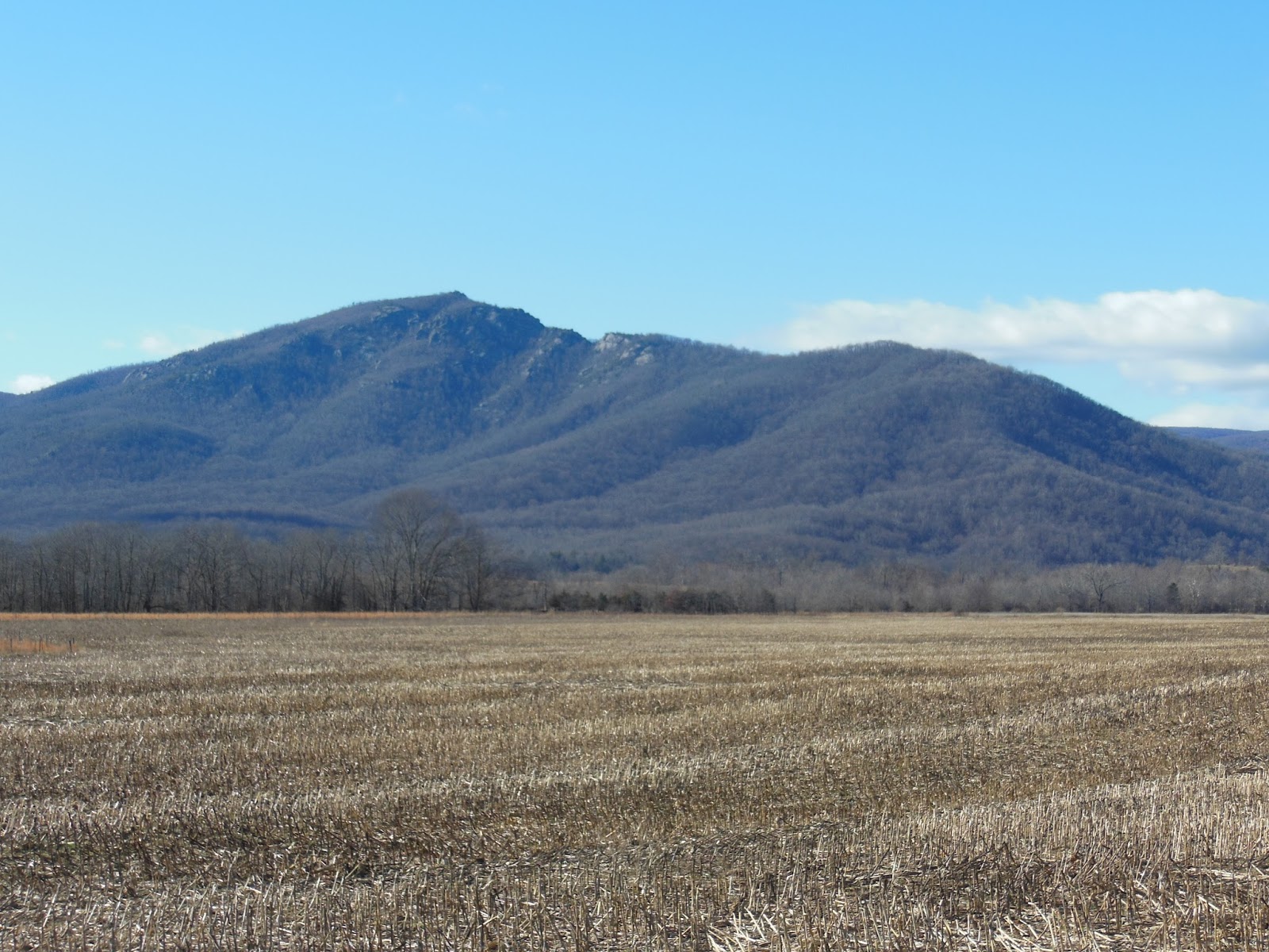
Pleasant incline
Sun and Rain
Clouds breaking up
Brighter and brighter
I hiked up the Ridge Trail to the rock scramble with little difficulty and encountered a half dozen day-hikers like myself with various levels of gear. It seemed that a few had no gear at all, no water or anything, just out for a walk up and back to their transportation. The clouds started to break up but there continued a fine rain, not unpleasant. The third photo above appears to be sun-drenched but the rain was falling and beautiful with the back light from the sun. The rain abated as I approached the scramble but everything was wet and the wind had increased significantly along the ridge.
Straight up through the gap
Above is typical of the scramble. Hiking sticks are useless and found themselves secured to my day pack. They took a beating as I hoisted myself over and under rocks brushing against hard surfaces, or as I tossed them up or down with my pack to a another vertical level. The rock surfaces were wet and slippery, but my trail runners are very flexible, so establishing a firm grip was much easier than with stiffer, harder-soled boots. I understand why rock climbers traverse rock surfaces in near stocking feet.
See the blaze but where is the trail?
Wait for it.
Voila
Gravity defying
These are just a few photos of the scramble; this rocky portion continues for almost a mile and required every bit of upper body strength I could muster and tested my rebuilt shoulder. It passed.
Atop the ridge amid the scramble but still short of the summit is a rock outcropping that is an ideal place to view the countryside to the east. Notice the fire plume in the distance. The morning was nearly gone so I stopped for a bit of lunch, rest and solitary joy. Afterward I proceeded up to the summit along the Ridge Trail (more scramble) and then down the Saddle Trail to the fire road.
Who put that rock there?
Good directions and abundant trail markings
Byrd's Nest Shelter #1
Past the scramble
Hmm, yeah I need that.
This privy has a composting design. Notice the section to the right of the upper structure. When the left side fills up, the cover on the right is removed, the upper structure shifted to the right and the cover re-installed on the left. Over time the "stuff" composts. Some appreciated trail maintainer supplies leaves and wood shavings in a bin inside next to the throne so, like mindful animals in the wild, one can cover their scat and assist the composting.
Old Rag Shelter - day use only and easily accessible from downhill
At a juncture just below this shelter the Weakley Hollow Fire Road descends for several pleasantly-graded miles to the trailhead. This is a yellow-blazed trail and I did, indeed, encounter two ladies astride their four-hoofed mounts out for a trot.
Weakley Hollow
Brokeback Run
Parting shot, late afternoon
At 2:30p I was back in the parking lot feeling exuberant about the day and how well I faired under the circumstances. This bodes well for future outings; I am choosing treks that I am prepared for physically and mentally, that are challenging enough to increase my trail readiness and that are enjoyable. There were two park rangers at the station, refilling the registration box, so I ambled over and quizzed them regarding registration. They stated that as long as I had my pass and ID I would be fine; a park official checking registration papers would look for those in my case.
Reflections: a well-planned and executed outing, no injuries, challenging conditions, beautiful views, lots of solitude (is that good?), proper number and style of layers to maintain comfort, love those trail-runners. Looks like I might be ready for an overnight which requires me to use my regular pack and long distance gear. A bit further away lies St. Mary's Wilderness, where I have hiked on a number of occasions and which contains a loop of trails with overnight camping. Looks like I am on my way back to what I truly enjoy: long-distance hiking on the AT (and other alluring trails).
Where: Shenandoah National Park, Near Syria, VA Distance: 7.9 + 1.3 (wrong trail) = 9.2 miles Duration: 5.5 hours Weather: Clouds to sun by early morning; 50s at higher elevation, 60s lower; breezy Elevation: White Oak Canyon (WOC) Parking Lot, 1160 ft. ascend to near Skyline Drive, 3400 ft. and back on Cedar Run Trail
After a 15 month hiking hiatus due to a left shoulder situation (that's a story way too long for a blog, a hint though - I spent a total 10 months in PT before and after surgery), I am back on the trail and a little out of shape. This hike was planned to see what I could do and how I would feel after being limited to walking around town and exercising at the gym. I did fine: no shoulder issues shrugging my day pack on and off, no lower body trauma, and a little more huffing and puffing up the WOC ascent than I would have a year ago but about what I expected. I wanted to get out in January so I could take some training hikes before logging some bigger miles this spring. Hoping for a warmer, clearer day than recent weather provided, Providence overruled nature for a perfect Thursday in the mountains. Before I set out I had breakfast with my Thursday morning guys at County Cookin'. I do not normally eat breakfast there - just coffee, but a pre-hike carb loading was in order. The conversation was stellar as usual; one of the seven participants countenance assumed a sanguine appearance and he stated that he had often wondered when he would find himself amongst a group of old men talking about all the prescription drugs they used. So the discussion goes. After breakfast around 8:00a I headed for Syria, VA and the WOC Parking Lot on Rt 600 just outside the SNP. I performed the last sorting of pack and equipment and crossed the boundary a little past 9:00a, relishing that Senior NP Pass safety ensconced in my wallet as I passed by the Self-Registration Fee Station: best $10 ever spent, just don't lose it.
Well-illustrated map of planned hike
WOC is one of the most popular hikes in the park due to its magnificent falls and relatively tame terrain. I have hiked up to the Upper Falls a half dozen times. I was looking for a loop hike of about 10 miles and this one presented itself. I had never hiked along Cedar Run so I was looking forward to some unfamiliar territory. The climb up to the Upper Falls, 1300 foot ascent, (blue at right of map) was predictable, save for the ice and snow still present. The trail was fine: not too muddy or slippery. I hiked past the falls to the west leading WOC Fire Road/Horse Trail.
Crossing Robinson River into SNP
Gentle
Surprise
Ghost-like ice apparitions
Ice/snow framed cascade
The yellow-blazed trail cut across the mountain face with a steady grade that rose another 1000 feet ending within 50 yards of the Skyland Drive at the intersection with the blue-blazed Cedar Run Trail heading back down the mountain.
Crossover to Horse Trail
Four-footed hiker
On the ridge
So after a quick lunch at the top I was feeling quite refreshed and ready for the quick trip down and back to the parking lot. Expectations of the trail are often illusory. Two things significantly affected my anticipated romp down the mountain: first was my lack of discernment regarding the type of trail alongside Cedar Run, second was my confusion regarding the trail connector between Cedar Run and WOC. What goes up must come down and those 2300 feet so tamely configured with switchbacks and a well-graded fire road going up were nothing short of a parachute jump going down. The trail hugged the Run closely so it was rocky and steep throughout and much wetter. There was also much more downed wood strewn across the narrow gorge. This contributed to cautious and slow going. I had read the detailed trail guide that accompanied the above map and had noted the distinction of the Cedar Run WOC connector with a mind that I needed to take it to get back to the parking lot. I had noticed going up where the Cedar Run Trail came in on the left so I just assumed that was it. Oops! If you look at the map closely you can see where the Cedar Run Trail (solid blue) loops back to WOC on its own, but the blue dotted connector is quite another story. I cut left and took the connector north and added another 1.3 miles to my trek by the time I hit WOC and headed south again. Not a major problem but a mistake you do not want to make which in other circumstances could have been costly and confusing (Am I lost?).
Trail?
The Side
Steeper that it looks
I realized what I had done when I came out on WOC and a bit later saw the Cedar Run Trail coming in on the right. I had the map with me but had not looked at it again during my descent, demonstrating poor orienteering skills. That's what training hikes are for. The trail guide suggested a 5 hour hike and with my leisurely pace and mistake I still made good time, returning around 2:30p to my beloved Ford Ranger that always waits patiently for me at those trail-head parking lots and roadside pull-offs. She was not alone; there were at least 8 vehicles around and I encountered 10 or so folks on the trail out for the day. Reflections: Good planning, good weather, a few surprises, fair execution, a few slips but no falls, good gear, beautiful sights and a wondrous feeling on being on the trail again. Next may be a hike up Old Rag and looping down the fire road. Then I plan to gear up (full pack) for an overnight somewhere in the SNP. I am just getting started (restarted).