
Date: January 7 & 8
Where: Shenandoah National Park around Skyline Drive MP 28 to north end of park near Front Royal, VA
Where: Shenandoah National Park around Skyline Drive MP 28 to north end of park near Front Royal, VA
Weather: Mostly sunny, 40s to start, near 60 in the afternoon on Day 1, 30 at night, near full moon, mid 40s on Day 2, bright sunshine
Length: 24.5 m
Elevation change: Beahms Gap - 2500'; Hog Back Mtn - 3500'; Gravel Springs Hut - 2700'; North Marshall Mtn - 3500'; Rt 522 - 1000'
Duration: Day 1, 5 hours of hiking; Day 2, 6 hours
It's been a while since my last hike; what with holidays and family events, some happy, some sad, this hike was twice delayed. But perseverance and the beckoning of fabulous weather for January lured me out last weekend, so that I could complete the AT section within the SNP. I have now completed a contiguous section of AT from Rt. 60 near Buena Vista, VA, north to Rt. 522, a total of 160 miles. When I add the 60 miles I have hiked around Hot Springs, NC that puts me just over 10% of the trail. I still have a long way to go but plans are brewing for longer trips, further from home. I feel like I am becoming more fit for backpacking with my regular walks at home and these "training" hikes. I want to be able to go out on any given day and hike with full pack between 15 and 20 miles, depending on terrain, and then get up the next day and do it again, and again, and again.

Day 1: Left home around 6:30a and with highway driving thanks to President Eisenhower made it over to Front Royal by 9 o'clock. I checked out the relationship between the trail crossing at 522 and the park entrance for logistics (5 mile separation), parked off road at 522, caught a ride with Corey, a local boy with some crazy tats, all the way to the entrance of the park and the Skyline Drive. Paid my $5 entrance fee and walked up to the kiosk to obtain my backcountry camping permit - I love the sound of that. Since I had planned to stay in the Gravel Springs Hut, 11.5 m from Beahms Gap, I assembled my "speed" pack, consisting of a large day pack with hydration system, no tent, a minimum amount of essential gear, and some food to see what kind of pace I could accomplish.

John and Olympus picked me up as they passed through the park entrance within about 20 minutes or so. They had planned a day circuit hike around MP 12 and offered to take me that far. We talked about hiking, the mountains, Springfield, art, family, dogs, Asheville, the beauty of the out-of-doors, and our common joy of just being out in it. John went the extra mile(s) and drove me all the way south to MP 28 and let me out at the trailhead; it is 10:30a and I am ready to go. Love those trail angels.
Being a Saturday and fine weather I fully expected to see a number of folk and as the day wore on I encountered a variety of day hikers. The terrain was not particularly challenging; those ups are getting easier and finding that pace that modulates the blood pounding in my ears and closed-mouth respirations is becoming natural. I pace myself so I essentially never have to stop but stop when I want to, usually about every hour or so for hydration and sustenance, and I rarely sit down or take off my pack. Catching a view lasts a minute or two just resting on my hiking sticks.
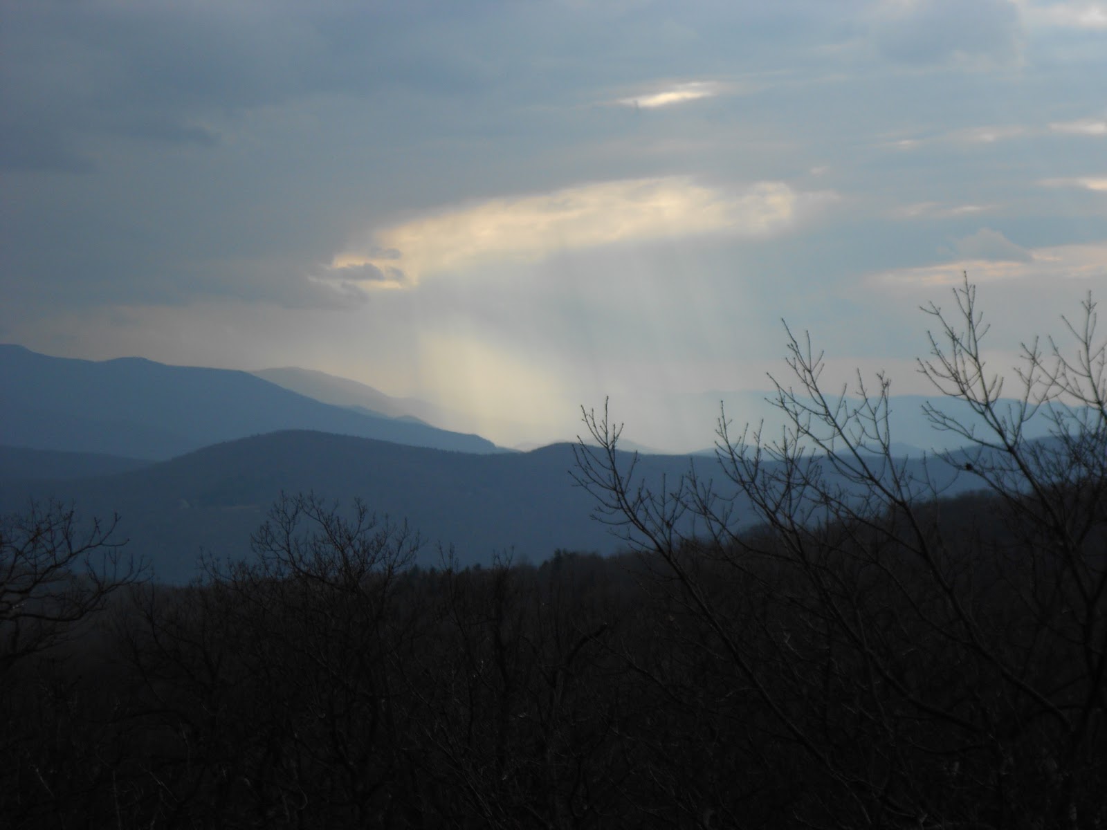
Clouds did crowd out the sun and a few raindrops fell, but nothing deterred me from my quest for a early arrival at Gravel Springs Hut. Open ridge trails predominated and with no leaves; vistas were plentiful. At one point there was a view where just beyond the mountain behind me there were 5 ridges piled one atop the other to the horizon, all shrouded in those magnificent shades of blue. I arrived at Gravel Springs Hut about 3:30p, feeling so fine and not particularly worn out, though I had hiked vigorously (I am in training) after having an extremely enjoyable day so far. Following are a number of photos that tell the tale better than I can.


Gravel Springs lived up to its name, easily one of the most productive springs I have encountered on the AT. Time to get out the old MSR ceramic water filter and fill up. Sweet delight! George and Andreas were already in residence, but had pitched their one-mans away from the hut. Two park rangers strolled up as I was unpacking in the shelter and we had a good chat: tax money well spent. They were out walking trails and keeping an eye on things. We talked about the unfortunate and untimely shooting death of a ranger near Mr. Rainer; those guys (and girls) put their lives on the line everyday and for them I am exceedingly grateful. My dinner buddies are part of a local hiking club, both retired, and we shared stories, gear talk, and chocolate around the warmth of a fire, banked to throw heat into the shelter. Bedtime 8:00p. A near full moon blessed the evening with stark shadows of barren hardwood limbs.

 After a rather steep descent the trail leveled off and a fence appeared on the west side. This 8 foot high chain link fence continued for at least two miles, all the way down to Sloan Creek on the south side of 522. This was some major investment as it followed a twisting hollow out of the mountain onto open farmland. I tried to imagine what kind of equipment was necessary to install that monster. Grapevines are attempting (and will probably succeed) to eventually take it down in this area. I crossed the creek with Lake Front Royal to the east and found the Ranger safely lodged in the parking area along 522. I decided to take the scenic route back to Richmond and headed south on 522 through Culpeper, Unionville, Mineral, Cuckoo, and Ferncliff, before hopping on 1-64 East. Feeling good! An amazing weekend on my favorite trail.
Mr Micks,
ReplyDeleteI am glad to see that you are doing great on your hike to mt. khatadin. Your blogs are incredibly inspriing. Along with this, and while reading "a walk in the woods" by Bill Bryson (fabulous book btw), I have decided that I will someday hopefully hike the entire trail as well!
Anyways, I hope the weather stays nice for you over the next couple of months. this winter weather in VA has been mild, and trends point towards a general continuation for that over the next few weeks. I hope you enjoy your time on the AT!
Regards,
Tyler Hutcherson