Monday, June 15, 2015

New Trail: Mt Holly Springs, PA to Port Clinton, PA

When: June 3 - 9, 2015
Where: Rocky Southeastern Pennsylvania
Weather: 7 days of near perfect weather; penultimate day, major afternoon thunderstorm with torrential rain and hail; slight rain on the last day.
Length: 104.6 miles northbound
Elevation: No more than a 1000 foot elevation change at any one time. My final descent into Port Clinton was a challenging drop: 1000 feet in less than a mile.

I have had a major long-distance backpacking goal in mind for some time: I wanted to be able to choose about a 100 mile section of trail, hike it in a week, and feel that at the end of the week I could just resupply and keep on hiking like many thru-hikers do. I have no desire to hike for extended periods of time, say more than two weeks. My life in Orange, VA is a blessed one and I enjoy being there so much I would not want to be away much longer than that. This goal would represent a level of preparedness (physical, mental, knowledge, experience, gear) at which I could hike along with many thru-hikers and enjoy myself. I am satisfied that on this hike that goal was accomplished: this is my first hike (except for that Philmont hike many years ago with the boy) that was over a hundred continuous miles, I averaged 15 miles a day including the starting and ending days that were not full due to logistics of getting on and off the trail, and I felt pretty good when M picked me up in Port Clinton last Tuesday. I admit that two days later my feet were sore and I suspect that if I had tried to maintain that pace without a break I would have paid for it with some unscheduled zero days (days on the trial with no miles hiked). On two hikes in the past I had succumbed to this ailment well before reaching the 100 mile mark and chose to go home. So, I consider it a great outing and I had a wonderful time hiking, being out-of-doors, and meeting a variety of new people who were doing the same thing I was. 

Day 1: M dropped me off near Mt. Holly Springs, PA where S and I almost three years ago finished a hike of about 50 miles, my first in PA. I hiked 8.0 miles to the backpacker campground just south of Boiling Springs over mildly undulated terrain on a ridge that included a natural rock maze. I was first into the campsite, set up my tent, and rested as other hikers (a total of 4) drifted in. The night was cool and pleasant with meaningful conversation around a small campfire. Hiker midnight - about 8:30p.
Rock Maze - see the arrow
Trail?
Original midpoint of AT
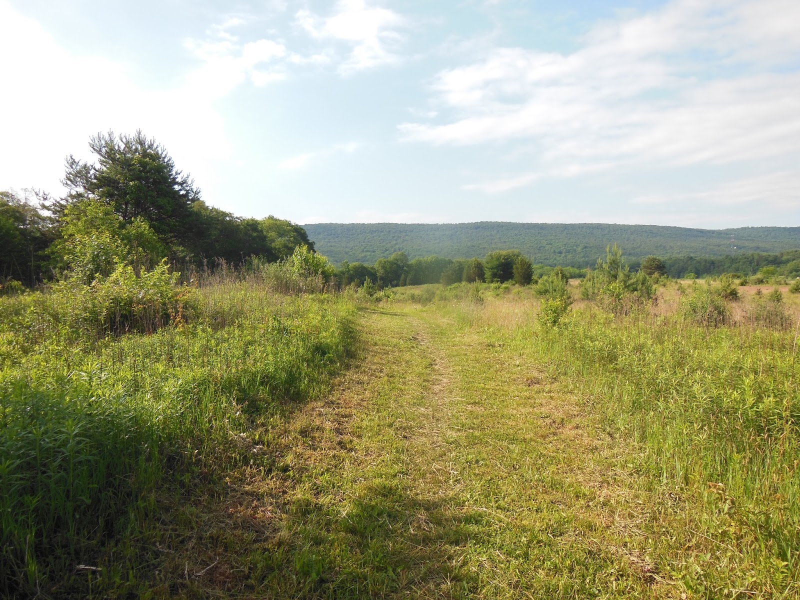
Pastoral
Hiker at center
Backpacker campsite near RR tracks
Day 2: At 6:45a I hiked into Boiling Springs, had a cold breakfast on the porch of the ATC regional office, and hiked the 22.1 miles through the Cumberland Valley past the Darlington Shelter to the Cove Mountain Shelter (I had a schedule to keep). That may seem like a lot of miles for my first full day out but the hike was basically flat until the ascent up the mountain at the end. Fortunately, it was an overcast day and some slight rain a day's end so I was not subjected to the brutality of a summer sun as I hiked through and around field after field. Six others shared the shelter, a nicely bunked affair. I spend some time with some of these hikers over the remainder of my trek. Pictures tell all.
Lake and Park in Boiling Springs
Conodoguinet Creek near Scott Farm Trail Work Center
Took lunch here as it was about half way to my destination.
Cove Mountain Shelter
Day 3: With a shorter hike (15 miles), I knew I could take it easier than yesterday and there was plenty of daylight to hike to the targeted shelter. Several of my shelter mates were hiking the AT 6 miles down from the ridge into Duncannon, PA (another trail town) and finding breakfast. I headed out last, hiked down into the Susquehanna River Basin and caught up with several of them at Goodie's on the main drag in town. She, the proprietor and cook, was ready with coffee and menus. I ordered a Western and Cheese omelet that came with fried potatoes and toast. Yum! The service was excellent and hiker-friendly: good bathrooms, a sink to fill up that empty water bottle, and plenty of outlets to charge those ubiquitous electronic devices, plus a reasonable price for a meal. The town is laid out along the river banks and the AT goes through town for about 2 miles to approach the bridge. The hike out of the gorge was pleasantly graded and I made good time arriving at the shelter in the late afternoon. The shelter was a two level affair and I took the top level since no one else wanted to climb the steps (the mature hiker set was in residence). Good conversation and pleasant evening temperatures prevailed.


Heading down into Duncannon .PA
A little rough; tree at center is vertical
Goodie's in left side of central building
AT path on right protected verge of bridge 
Big river
A look back 
Lunch break at Clarks Ferry Shelter
Peters Mountain Shelter
Interior with loft, ladder, and picnic table
Day 4: The 18 miles planned for today were relatively flat ridge line stuff with a drop into and out of Clarks Creek where PA325 filled the gap. The hiking was about the same as previous days with really good weather: sunny and not too hot under the canopy. Near the end of the hike I passed into a defunct coal mining area; there were literally tons of fine debris about, some in large mounds, some scattered around the trail verge and at times the bed of the trail, actually quite pleasant to walk on since is was very fine and packed evenly. As I turned east off the main trail to the 0.3 mile access (blue-blazed trail) to the shelter I found myself on a wide level road of the same material that was surely manmade and extended beyond the Rausch Gap Shelter into a beautiful camping spot. The road passed by on the right and pitched steeply down into a gorge. The shelter had a great spring within its rock surround; the water source was coming out of a pipe from under the road into a trough that made for easy cleanup. I enjoyed a mini-bath here that was invigorating. The shelter was small and nearly full and I had been considering tenting anyway: good choice. I wandered over to the campsite and set up my tent on a level grassy patch. A young couple and one of my mates for the past few days were ensconced around the fire ring. There were a number of other campsite about and one back on the road was occupied by a Boy Scout troop. That brought back memories. There was a breeze and the evening temperature dropped quite a bit requiring the donning of a jumper and hat. Good sleep this night.
Power line crest view to east
Power line crest view to west
Small rock bridge over spring
Do not drink this water
Trail to shelter: old mining road
That's my stuff
Bausch Gap Shelter, was full but now empty
Day 5: Another 18 mile day would take me to the 501 Shelter over similar terrain. I leap-frogged with many of the hikers I had met over the past few days. The 501 shelter is located a few hundred yards from PA501 which leads to Bethel, PA. The shelter is an enclosed bunkhouse with 14 spaces, 7 up, 7 down, and a large center table with octagonal skylight, no electricity. A caretaker lives in an adjacent house with running water which is connected to a solar shower via rubber hose. The two large black tanks rest above and absorb radiant energy from the sun to knock the chill off the well water, but on a cloudy day not much happens. Several folk endured the chilly spray, but I chose to just rinse off by the spigot. Ritual has it that all in the shelter band together for a mega pizza order from town. We all weighed in and 10 pizzas with soda showed up late in the afternoon. Yum! I played gin rummy with Kilroy and the group enjoyed being inside and comparatively comfortable. I ate 6 pieces of my large pepperoni, holding back two pieces for tomorrow's lunch.
Bat box
Oxeyed daisies
Fallen tree bridge over creek
Couple I met at Rausch Gap campsite
Iron bridge at Swarta Gap


PIZZA!
Day 6: The big miles were behind me know and the trail was pretty much flat until Port Clinton, PA, the end of my trek. The 15 miles to Eagle's Nest Shelter were typical rocky ridge line and overgrown trail with a few views. There was a forecast of severe thunderstorms at mid-afternoon, so all of us hikers had in our minds to reach the 8-person shelter before the deluge. Since the shelter was only 9 miles from Port Clinton, some would push on into town, but most would pull up short at the shelter for an overnight, then hike the miles into town in the morning with plans to stay overnight and then head out the next day resulting in what is termed a couple of nero (sounds like zero) days. To zero (a verb) means to not log any miles; to nero means to hike less than a full day which allows for town activities like laundry, resupply, eating and eating, and staying in a hostel or motel/hotel. Staying two nights with a rest day in between was on some hikers agenda. I arrived at the shelter around 3:00p, making very good time. Only a few folks were in, all of whom I knew. We claimed spots in the shelter by spreading ground cloths or sleeping pads. As the afternoon progressed more and more hikers showed. I felt a little guilty about taking a spot as a section hiker when many thru-hikers would be showing up in hopes of having a spot out of the rain, but the protocol is first-come, first-served. A large group showed just before the heavens opened and made decisions about where to tent or just wait to see what happened. The eight spots were taken and, without grumbling, later arrivals made plans. One couple pitched their tent in the eave of the roof on one side, a good choice. Others pitched tents, stowed gear and then just sat around the shelter. When the storm hit, the folks inside the shelter slid further back to allow for others to pile in totaling about 15 people. During the rain/hail storm another 5 or so showed up, looked forlornly into the crammed shelter and set about pitching tents in the rain. Now most of these folks had been on the trail for a couple of months and had already hiked over a thousand miles, so this was nothing new and they all took it in stride. After the major brunt of the storm passed rain continued through the dinner hour into the night. All quieted and the night was spent at peaceful, and in my case, warm and dry.
More rocks
Mountain Laurel 
Unusual marker
Pizza lunch break
Lots of information
Shelter filling up
Storm coming
Day 7: With only 9 miles to finish I was pretty excited. M was to arrive in Port Clinton at 12:00n, so I had plenty of time to hike the ridge and down into the gap. Since there were so many hikers about the trek along the ridge and down into town was peppered with stops and chats about getting off the trail, who was staying in town, who was going to zero, and most significantly where to meet up in town: The Barber Shop. The last mile of the trail is a steep, rocky descent, but much effort had been expended by trail crews to arrange steps to help make the trail safer. I slowly picked my way down and safely arrived at the railroad tracks and the entrance to town. I made my way over to the barber shop across from the Post Office where packages were awaiting hiker pick up when it opened. The barber shop was known for being extremely hiker friendly, offering coffee and donuts or cookies. The proprietor addressed every hiker with questions about trail name, hometown, reason for hiking and plans. He did not cut hair while conversing with hikers so a haircut could take about 90 minutes, but no one cared. I had discussed the virtues of M's Volvo XC70 with a hiker who had worked for Volvo, so he was familiar with her vehicle. As I was making a pot of coffee inside, he stuck in his head and announced that a Volvo had just turned the corner and was headed down the street for a turnaround. Out I came as M drove up. What a welcome sight: hugs, smiles, and kisses. After a few goodbyes we were off on our return trip to Orange. Go figure: I had just spent about 50 hours hiking 100 miles of trail over the course of 7 days and we would find ourselves home, some 250 miles away in 4 or 5 hours - two radically different experiences.
End of steep steps into town
Old rail bed and bridge
Into town, PO on left and barber shop on right at street's end
Magnificent tableau tells much, see my pack on left?
Hikers and customers enjoying the moment
Good haircuts for a good price

Friday, May 1, 2015

New Trail: TN 91 to Dennis Cove Road, TN

Watauga Lake
When: April 20 - 22, 2015
Where: Shady Valley, TN (TN 91) to Hampton, TN (Dennis Cove Road USFS 50)
Weather: 2 days of cold spring weather, mostly sunny; last day slight rain
Length: 29.1 miles southbound
Elevation: Cross Mountain Rd. and TN 91, 3525"; Iron Mountain Shelter, 4118'; Vandeventer Shelter, 3579'; Watauga Lake Shelter, 2100'; Pond Flats, 3707'; TN 321, 1984; Laurel Fork Shelter, 2186'; Dennis Cove Road, 2550'.

Day 0: This near 30 mile stretch is the remainder of my last hike In March where, for a variety of reasons - bear warnings, first time out, a potential long hike with serious ascents and descents (am I ready for this?), and that inner prompting saying, "Be careful" - I skipped over the Watauga Lake Area. M and I planned a 4-day trip to Asheville, NC to visit our relatives, all conveniently installed at the Deerfield Episcopal Retirement Community. We traveled to Asheville on Monday (4/20), I dropped M off there and headed for Kincora Hostel up the mountain from Hampton, TN. I met BP with whom I had previously arranged an overnight at the hostel and a ride over to my starting point in the morning. I stayed here last time but elected to sleep in the Volvo since all my stuff was in there and I did not want to move it and I did not want to deal with the cat smell that permeates the place. I hope some Spring Cleaning is in the plan. Actually, I had a pretty good sleep in my down bag floating on my air mattress. I stayed dry and warm under stormy skies. I was parked on a slight incline on packed earth and gravel and when the heavens opened, the rain woke me pounding on the car roof. I wondered for a bit if the deluge was sufficient to reduce the friction between my tires and the ground resulting in slow but accelerating drift down the parking area into the gravel drive and the brush below. Interesting what comes to mind in the middle of a dark night. Nothing happened.

Day 1: Up before the sun, I packed up with minimal gear needed for one overnight in a shelter. Probably the lightest pack in recent history: no stove or fuel, no extra clothes, no tent, no extra food (all meals where prep-less). After an hour car ride I hit the trail about 8:00a with all upper body layers on: long-sleeve polyester knit shirt, long-sleeve polyester plaid broadcloth shirt, polyester green half-zip jumper, and rain jacket. Even sporting kilt below I was comfortable in the 40F windy conditions along the ridge of Iron Mountain. A couple miles in I passed my first NoBo who alerted me to several trail features including the Nick Grandstaff Monument. Stopped at the Iron Mountain Shelter for a rest about half way through my 11 mile day along the Iron Mountain ridge. There were many NoBo thru-hikers on the trail and at the shelter; I suspect I saw upwards to 30. During the entire time I did not encounter one hiker headed south as I was. I arrived at the empty Vandeventer Shelter around 1:30p to sunny skies but continued cold and windy conditions. If I had brought my tent and was not scared away by ignorance of any camping spots ahead I could have hiked further and lessened the longer hike tomorrow. It was beautifully poised on the ridge, so a good spot. A few folk stopped by before moving on and I had settled into reading in a sunny spot at the rear of the shelter with a marvelous view of Watauga Lake. I had switched out my kilt for some polyester leggings (not tights) but the wind finally drove me into my sleeping bag: it is just too comfortable in there with the sleeping pad inflated beneath. Around 4:30p two young ladies arrived and where finished for the day. The had served together in the Peace Corp in Micronesia and had education degrees and teaching experience. Both were at transitional times with career choices and decided to thru-hike the AT before the next phase. They were delightful to chat with. After chow one named Ukelady, unpacked her ukulele and serenaded us with a variety of songs. She sang beautifully (her best instrument)  and was so relaxed and confident that the setting was not a performance but a sharing. We watched the sun drop behind the ridge through clear skies. Hiker midnight arrived at about 8:30p and all went quiet as each snuggled into their bags. I had hiked along the Iron Mountain ridge all day to slightly undulating terrain, no significant foliage present, expansive views, some signs of spring -  a most enjoyable but cold day.
No leaves yet
Ridge trail
Iron Mountain Shelter with Nobos
Great water source at bog
About water: shelters are most often placed near a water source for obvious reasons, but, though close, may not be easy to get to. The upcoming shelter, Vandeventer, has a spring but it is located 0.5 miles down from the ridge resulting in a arduous descent and strenuous ascent - not something a long-distance hiker relishes, especially at the end of a long day. Therefore, being aware of more conveniently positioned sources prior to a day's stopping point, can result in easier access, which was the case at the "bog" source. I loaded up, but the trade-off is that I had to carry most of that load (6 pounds) 4 miles. The terrain ahead was relatively flat, and my pack was light to start with so the decision was easy.
First glimpse of Watauga Lake - east end 
River valley
History
Views from rear of shelter
Late afternoon view into shelter
Shelter with self-portrait
Thru-hiker on left, my stuff on right
Day 2: In order to finish my 29 miles I planned to hike 18 today. I cannot say I was dreading the day, but the length and terrain of this stretch caused me anxiety the last time out to the extent that I did not hike it. I would have preferred to (and had originally planned to) break this up into two days of more reasonable hiking. I knew I could do it, but under the circumstances now of a rigid schedule some anxiety persisted. I was up and out by 7:00a; the girls were awake, nursing some bagels and cream cheese from their town visit yesterday. They were still nestled in their bags as I left with fond expressions of success for the day. Since I was hiking north to south I had a long well-graded 6 mile descent (instead of an ascent if I had been hiking the other direction as originally planned) along the ridge toward Watauga Dam. The weather was fine but the forecast suggested rain later in the day. I had lake views all the way down to the dam and my pace was brisk due to smooth switchbacks and few rocks. Ahead of me was Pond Mountain. To pass the top of Pond Mountain, named Pond Flats required an ascent and descent of 2000 feet over the course of 6 miles. For some reason I had been questioning how difficult this stretch would be; this was another reason I was fearful last time to hike this stretch. I had a lighter pack this time, so the only way was forward at whatever pace I could manage. I was quite surprised with how well I hiked this mountain. I had rested at a lakeshore park with two thru-hikers and given them some of my extra food and I had imbibed a significant amount of water and carried little up the mountain knowing that there was water at the top. The uphill was again well-graded with consistently pitched switchbacks. I strode up at a good pace and rested little on the way up. I felt great, so the combination of pack and personal weight management and those spin classes at the gym paid off. I had underestimated my fitness and preparedness for this hike. I had scaled more difficult mountains (remember the Smokies) but I had just let doubts creep in about this stretch. I must remember as I plan other hikes to reflect on this experience when looking at trail terrain as I plan itineraries, not to overdo it but to be more realistic with what I can do. Sometimes being conservative with expectations is good, but I have been doing this for a while and I should let my experience weigh in.

About campsites in this section: Three things conspired against me when I bailed on this section before: the Watauga Lake Shelter was closed as well as 4 miles of trail near it, I received a verbal assessment from a knowledgeable person that there were few if any good camping spots north before the Vandeventer Shelter and my trail guide indicated none as well. As I hiked through I found the assessment and other information false; there were several really good sites where I could have easily camped north of the closed shelter on that previous hike and been able to break up that long stretch as originally planned, but my ignorance of the trail and the information in hand at the time left me wanting. When packing a tent on future hikes I can be a bit more daring about not being so wedded to the shelter areas and do as most thru-hikers do which is hike a good day, then stop for the night wherever seems best.
Morning view 
Pleasant descent but do not step too far to the right
The dam is much bigger than it appears here
Standing Pine
Wattage Lake Park
Dam at rear of picture
Laurel Falls were positioned near the end of the day's hike; in my trail guide they were at the bottom of a reasonable descent with a steep ascent to exit the river gorge. I had seen much cascading water already. The girls at the shelter had advised me of a blue-blazed high water trail from the back of the Laurel Fork Shelter that stayed high and bypassed the falls. It is OK in my mind to hike alternate trails in the vicinity of the AT as long as they are part of the system and are at least as long as the parallel AT. I had already decided to take this high road to avoid the terrain and get to my day's end a bit sooner to be back in Asheville before it was too late to visit with my MIL. I hiked along the river (Pond Branch I believe) until I reached the blue-blazed trail up to the shelter. Up I when with every intention of proceeding past it and along a the upper branch trail avoiding the falls. Well, as on my previous hike someone had a different plan. There was a blue-blazed trail beyond the shelter which I followed to its apparent end at small stream flowing over some rocks. I looked up, down, across, around and could not find anything that looked like a trail. There was dense undergrowth on the less used trail. I walked back a bit and considered the blue markings to make sure I did not miss something but found no other path forward. Frustration bloomed as I was searching. I was so annoyed at whoever set up this high-water side trail or failed to maintain it so that it was useful. I was confident that it was there somewhere but again my lack of knowledge and adventuresome spirit to probe around left me with no alternative but to hike back down to the shelter, down to the trail, down to the falls and then make the steepest ascent of the day out of the gorge. I was not a happy soul, but as I hiked down I mellowed into the realization that what was ahead was what I was going to do so I might a well make the best of it. At least it was not raining yet. The trail down to the falls was not so bad and the falls were worth seeing but the hike out was not what I expected: a jumbled  staircase of large rocks. It had started to rain so things became a little slippery and I wrestled into and out of my rain jacket a few times (by this time whether I was wet or not would not matter). I reached the top a little weary, but I had not pushed myself too hard and was presented with the remainder of my hike to Dennis Cove Road, about 2 miles. The last bit was quite pleasant and I was starting to feel the sense of accomplishment that reaching that road would bring me. I arrived at the intersection of trail and road with joy and a few fist pumps, turned toward the hostel and the Volvo. No one was present so I changed into some respectable clothes and headed down the mountain. After a meaty and carb-laden dinner at Mickey D's in town I made my way back to Asheville.
Laurel Fork Shelter
Laurel Falls
Trail was even steeper in places
Closing the Gap: so why those euphoric fists pumps and feeling of accomplishment? Section hikers cobble together pieces of the trail with the hope that eventually all those sections will add up to the entire AT. Over the past few years I have hiked the AT closest to where we live and in the vicinity of Asheville, NC. With the completion of this hike all my pieces are now connected into one continuous 950 mile section from Fontana Dam, TN (just south of the Great Smoky Mountain National Park) to Mount Holly Springs, PA (50 miles north into PA across the Maryland border), about 45% of the entire AT. Am I finished? No. What's next? I am still considering. Am I going to hike the entire AT? Well, I have thought from the beginning of these adventures that I would, but there are other places to long-distance backpack that have appeal, so I am not passionately attached to just the AT. Short term I plan to hike more into PA to extend my section northward and then possibly in the fall go to Fontana Dam and hike 165 miles south to Springer Mountain, GA (southern terminus) expecting to encounter some thru-hiking SoBos who started up north in Maine and are hiking south. Longer term I have my sights set on the John Muir Trail (part of the Pacific Crest Trail) near Yosemite National Park in the High Sierras, and the PCT that traverses Oregon across the Cascade Range. Will those hikes happen? Who knows? Much of the hiking in the southern Appalachian Range is similar, though up north things do change, but a change of scenery to our western mountains seems attractive if not daunting in distance and arduousness. 

There is still little to compare with the experience of donning those trail runners and kilt, hefting a backpack, and striking out on a long section of trail. It's really in my blood now and I long for more.