|
| Fontana Lake from auxiliary spillway |
When: October 19 - 25, 2015
Where: Southwestern North Carolina
Weather: 7 days of near perfect weather
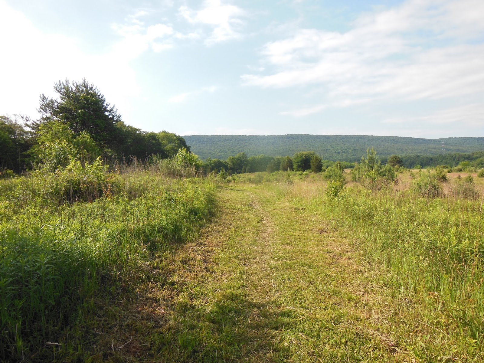
Length: 55 miles southbound
Elevation: Total elevation gain and loss over the trek was about 12,000 feet with several 2000 to 3000 foot ascents and descents.
Pre-hike planning - There is a 166 mile section of the AT from Fontana Dam to Springer Mtn. (the southern terminus of the AT). When I logged 105 miles on my last outing with excellent results I considered hiking all 166 miles to complete the entire southern stretch of trail. Did I need to hike this entire section for a particular reason? Probably to log another serious long-distance hike and to accomplish another stage of my AT Adventures. What was I going to experience?
So my MIL who lives in Asheville, NC was celebrating her 95th birthday and we drove down for that with the plan that M would transport me to Fontana and I would head out for Springer on a two week jaunt. We had mailed two resupply boxes to trail outfitters who provide a service to receive, hold, and distribute boxes for hikers, since I planned not to carry more than 5 days of food (about 10 pounds). I was prepared to stay out at least 12 nights, 13 days, most probably more. My first resupply was in Franklin, NC, so I orginally planned to hitchhike into town, grab my box, and get back out to the trail in the same day. After I arrived in town plans changed and I ended my trek for a variety of reasons.
Day 1: Monday - With business in Asheville taken care of in the morning, M and I headed for Fontana and arrived around 12:00 noon and after some sorting and settling I was off to the Cable Gap Shelter about 7 m away. I saw Mass at the dam and met him later near the boat dock. After about a 2000 foot climb I settled into a steady downhill into the sparsely populated shelter. Mass had advised me that there were a number of SoBos most flip-floppers (start the trail in the middle, hike north to Katadin, ME, return to the middle, hike south to finish at Springer in GA). Lovely day for hiking and all went well. Fairly easy footpath with many lake views along the ridge. I was alone in the shelter with some folks tenting nearby. I had a chat with the father of a father/son pair hiking a section and had time for some good reading. Hiker midnight: 8:30p.
 |
| Fontana Lake - auxiliary spillway |
 |
| Fontana Hilton |
 |
| About ⅔ of climb to this point |
 |
| Cable Gap Shelter |
Shelter Note: This is probably the most basic shelter I have slept in; no privy; the water source just a trickle but someone had fashioned a leaf sluice and with patience I was able to capture plenty.
Day 2: Tuesday - Up and out by 8:30a (it's pretty dark early), heading for Sassafras Gap Shelter. Today included another 2000 foot ascent up over Cheoah Bald then down slightly to shelter. Another beautiful hiking day with many hikers out. Met what I call "The Group of Five" over the course of the day. Mass was part of this group, but their leader "Hollywood" was not in sight until the shelter. She was popular among the hikers who had met her and I found out why later that evening. I finished my 15 m by 5:00p, and was pretty much done. I felt OK (no pains or blisters) but was exhausted in that good end-of-a-big-day manner. The group coalesced around the arrival of Hollywood, a lovely and sophisticated young lady who hailed from Alpharetta, GA, not far from trail's end. These other 4 guys had glommed onto her a week or so back, were captivated by her charm and beauty, and had given over all final trek plans to her wisdom, since they had decided to "summit" Springer Mtn. together, and celebrate their achievement with a party at her home. Her mom was coming to pick them all up sometime next week. There were many other folk around the shelter, and someone had started a fire to knock back the chill of the evening. Hanging with this group was the highlight of my hike. I thoroughly enjoyed their company and later one member suggested that I finish with them at Springer, but I quickly reminded them of their blazing pace (20 m per day minimum) which I could not maintain. After dinner I settled into the warmth of the fire ring and chatted with those there. Hollywood came and sat beside me and we had a delightful chat about life and experiences. She could charm the socks off of a mega-boot wearing lumberjack standing in three feet of snow at zero C. No wonder those guys would follow her anywhere. As they bedded down she advised them of what they were going to do and hike tomorrow and they just said that sounded fine. Night further cooled and we filled up the lower level of the shelter and dozed off.
 |
| Plenty of trail like this |
 |
| Fontana Lake |
 |
| Brown Fork Gap Shelter - lunch break |
 |
| Welcome sight |
Note on blazes: I have mentioned before my somewhat anal retentive behavior regarding these 2 x 4 inch white stripes of paint that mark the Appalachian Trail and differentiate it from other trails that cross it (usually blue- or yellow-blazed). One should expect to see one about every quarter mile either on a tree or possibly painted on a rock if appropriate. So I am mindful of them and grateful when I see them to assure I am on the trail. Anxiety ensues when I realize I have not seen one in a bit, even though I am sure I am on the trail. They are comforting to me. Well, as I hiked out of Locust Grove Gap I believe I saw my last blaze until I reached The Bertram Tail crossing (the one in the picture above), which was a space of 2.4 m. During that time I was sure I was on the trail: there were no side trails or significant changes but still I found it unnerving because if I had made a mistake then I was getting further and further off course. I decided that after hiking this far I was not going back and would just face whatever presented itself. Relief washed over me when I saw this one after a mile or so a name-calling those responsible for these markings. There were plenty of trees alone the trail they could have marked.
 |
| Cheetah Bald |
 |
| More Cheoah Bald |
 |
| Sassafras Shelter - a two level palace, great water, privy, fire ring |
Day 3: Wednesday - Today I had to hike into an out of the Nantahala River Gorge, one of the most arduous stretches of the AT. I had not been looking forward to this hike; not dreading it but still intimidated. I knew I just had to take my time and pace myself in such a way is to not jeopardize the remainder of my hike. A 3000 foot descent over 6.7 m arrives at the river crossing at the Nantahala Outdoor Center, known as the NOC. The nearby Ocoee River hosted the 1996 Olympic white water events. The Center is a small community devoted to supporting groups and individuals enjoying the trail, the river, and the mountains. The trail was well graded and I arrived around 11:00a and caught up with he "group" preparing for a hiker hamburger lunch at the River's End Restaurant build along the river. I feasted on a Patty Melt and fries while others devoured protein and liquid carbs in large quantities (I had only been on the trail for two days so was not subject to hiker hunger; they finished my fries). To hike out of the gorge, I had to ascend 2500 in 6 m to the Wesser Bald Shelter. Actually, I managed pretty well and surprised myself when I completed the last extremely steep section and realized I was at the top (for the day). When I hike uphill like this, I pace myself so that I can just feel (and hear) the old pumper in my neck and head, about 140 bpm, and can still breathe through my nose or talk. That means in some stretches I am basically taking baby-steps, but not stopping; just moving up at a manageable pace of probably one mph (as opposed to 2 to 3 mph on flatter trail). Over the afternoon I saw some of the group but knew they were going on to a shelter 6 m beyond my goal for the day; I would not likely see them again. I reached the shelter at 4:30p again feeling very good and somewhat accomplished. I spent the late afternoon at the shelter reading and eating and bedded down solo at 8:30p expecting to be alone, not a happy thought after the stimulating night last. Before I dozed off a flickering light jittered inside the shelter as Kevin made his way in the otherwise dark into the space. We was good company and as he settled in we talked well into the night; he was a new backpacker and had many questions about gear and trail. He was in good shape and fairly well outfitted, but he appreciated knowledge from a 1000 m hiker.
 |
| Group of Five and Hank |
 |
| AT across river |
 |
| FOOD |
 |
| Down river - fun stuff to do |
 |
| Wesser Bald Shelter |
Day 4: Thursday - I had planned an easier day today after the 15 m two days ago and the big gorge hike. After a brief chat with Kevin (he was leaving early) and breakfast I was out by 8:30a, seems like with the late dawn this was a reasonable time-of-day to depart camp. At Copper Ridge Bald (small out cropping) I met Eileen and husband. I had seen them down at Tellico Gap where they had met a guy to shuttle them to the top for a day-hike down. I leisurely hiked the remainder of the morning's 5.8 m over to the Cold Spring Shelter and stopped for lunch. Loquacious Don showed up and between eating lunch and listening to him (I got in few words) I spend an hour and a half at the shelter, something I rarely do, given my propensity to move on down the trail (not smelling enough roses). I had plenty of time and wandered into the empty Wayah Bald Shelter around 4:00p. Wow, what a shelter: good water, privy, and perched on the side of the mountain with a view overlooking the valley to the east through thinning leaves. I read, ate, and settled in to what could be another solitary night in the shelter; I was feeling a bit lonely.
 |
| Morning view, low clouds |
 |
| Surreal |
 |
| Wesser Bald Fire Tower |
 |
| Tellico Gap |
 |
| Hank and Eileen |
 |
| Lunch break |
 |
| Cold Spring Shelter - Don on right |
 |
| What does all this mean? |
 |
| Wayah Bald Shelter |
 |
| View with privy on right |
Uncertainly strikes: Mobile phone reception had been remarkably good in this area so I had been keeping track of the weather, knowing that before I set out rain was forecast for my second week. I became aware of the big hurricane hitting Mexico and Texas and heading my way in southwest NC and north GA. I had planned on going into Franklin, NC in the morning, grabbing my mail drop, and heading back out to hike a few more miles to a shelter for a 14.8 m day I had been feeling like I wanted to take a break in Franklin, so I decided I would hitchhike to Three Eagles Outfitters (holders of my box), get a recommendation for a hiker style place to land, get over there somehow, get cleaned up, eat some town food, relax, and head back out to the trail the next morning thus being only 4 m off my plan - not bad. The hike had been good so far but I was pushing myself a bit hard overall and was not looking forward to multiple days of rain. I would sort out my feelings in town. I bedded down to a fairly comfortable night, but woke up at about 3:00a and as I started thinking about going into town I realized that it was going to be Friday and I was in the middle of the mountains, in late October, when millions of people head for the mountains to see colors. I questioned: O crud, will there be any rooms in Franklin? I tossed about for a while and then around 6:00a made some phone calls; everything seemed to be booked due to all those things I thought of as well as a Josh Turner concert nearby. I finally got in touch with Ron at Haven's Budget Inn (very hiker friendly) and he said he would not know until check out, but to get in as early as possible. Swell, know I was anxious about all sorts of stuff and I just wanted to get into town. Not having fun.
Day 5: Friday - Another beautiful day presented itself, but I could not tell yet since I was out of the shelter at 7:00a, in the dark with headlamp blazing. As light increased so did my pace; I was nearly racing down the mountain to town 11 m away. I stopped a Wayah Bald and the stone tower and chatted with some folks who drove overnight from Florida and were still awake since they could not find a place to land nearby. Oops. At 8:00a I called Ron again to see where I stood. Thankfully he clarified his earlier (sleep soddened) commentary, stating that he would have something for me but to arrive after 11:00 and before 5:00p; that's what he meant by getting in early. Whew! feeling better. Though I hiked faster than normal, I was careful and settled into the rest of the morning. At Wayah Gap I met the first of the Olivia and Jansen group: fourteen family members, from grandpa downward, stretched out over several miles of trail enjoying a weekend backpacking trip. Olivia was the gregarious one and Jansen more taciturn, but they were well-behaved and polite, a credit to there parents, whom I met later on the trail. Those kids were burning up the trail to their camping spot and not interested in being seen with any other family - typical teenagers? I met many more weekend hikers and a contemporary with a well-behaved dog doing the reverse of my planned trek. I heard the vehicular drone from some miles out encouraging me downward. I broke out into Winding Stair Gap at 12:45, crossed US Route 64, to the parking pull-off and stuck out my thumb. Within two minutes Mary pulled over in her full sized pickup and hauled me and my stuff into town. She was gracious enough to take me to the outfitter (box was there) and then over the the Budget Inn. Ron's righthand man in the office welcomed me, gave me the hiker rate (cash only), and led me to my room. He also verified that Ron or somebody would take be back to the trailhead at 9:00a tomorrow, their standard shuttle out time. Clean, fresh, but a little rough around the edges, the room and setting were just fine for me to settle a bit and figure out what was next.
 |
| Sunrise |
 |
| Wayah Bald Tower with Florida folk |
 |
| Color |
 |
| Piped spring at USFS 68, self portrait |
 |
| Jansen and Olivia |
 |
| Siler Bald |
 |
| Plenteous water, self-portrait |
Day 5: In Franklin, NC - After a shower and a catch up on the news and weather (not looking good), I decided to walk up onto Main Street and find a late lunch: sunny, warm, breezy, beautiful. I found lunch at the Motor Company Grill on their patio: more meat and carbs, including a rarely imbibed Fat Tire Amber Ale. I strolled back toward the motel and spied a rathskeller advertising live music and sophisticated brews, it was Friday night. I checked in and got the scoop; could be a possibility for avoiding a lonely evening.
 |
| Haven's Budget Inn |
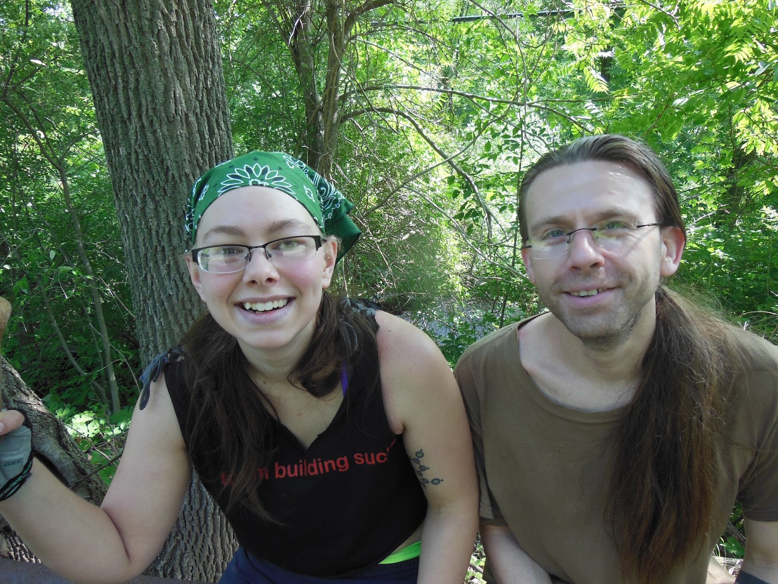
As I wandered back into the parking lot, I saw an older gentleman seated in a lawn chair adjacent to his room a few doors away from mine. I said hello and he responded amiably. I approached and we began a nearly two day conversation. He introduced himself as Henry and we delighted in our namesakes. He was 10 years my senior and an experienced outdoorsman: hiking, backpacking, hunting, fishing. He was also an adventurer, especially since his wife had died some ten years ago. I won't regale you of all we discussed but it suffices to say that we had many things in common but differed as well in many ways. We settled into a congenial friendship. I went back to my room to take care of some business: sorting food, checking the weather, calling home, reviewing hike plans, what to do for dinner. I decided to return to the lunch spot for a salad but found the queue to long to wait (lots of folk in town now). There was much busyness about Main Street as the yearly Pumpkin Festival was being set up. Vendor and public service booths were being erected all along a closed section of Main Street as well as on a major cross street that was being converted into pumpkin roll lanes reminiscent of the old Soap Box Derby of my day. This is a mountain town built on the slopes of the terrain, some roads horizontal, like terraced walkways, and others straight up and down the hills. Tomorrow would be a fun day for those in town. I walked down to McD's and grabbed a grilled chicken salad that turned out to be quite good. I carried it back to the motel, pulled up a chair near Henry, ate and enjoyed his company. He hailed from South Carolina, but was up here making small day trips to view waterfalls based on a guidebook he had with him. He stated he would be looking at some falls tomorrow and then was thinking of heading to Hot Springs, NC to visit Elmer of Sunnybank fame. Soon we both tired and I headed off to bed with visions of hitting the trail in the morning with some serious rain in the forecast.
Day 6: In and about Franklin, NC - I woke up early to be ready for my shuttle and as I listened to the weather channel, I became increasingly anxious about the huge storm now over Texas and headed this way. If I went back on the trail, I was basically committing to another 6 days of hiking with half of those potentially in very foul weather. Crud, I was not looking forward to this. My anxiety built and I realized I needed to make a decision now. Delaying my trek would do not good, since the serious weather was still a day or two away. I was either going ahead or going home. I called M and we discussed my situation and my anxiety about it. Isn't this supposed to be fun and why was I letting myself get all bothered? I realized once again that I had fallen into the trap of just cranking out the miles. I wanted to complete this section so I would be finished with the southern sections of the trail, not because there was anything in particular I wanted to see. I did expect to experience some more hikers ending their trek at Springer but one is uncertain who or what you may encounter on the trail. I also realized that the 55 miles I had hiked so far were not much different that many other miles hiked in this area and the next 8 to 10 days would look pretty much the same. Hadn't I told some folks recently that I was not committed to hiking the entire AT, but wanted to branch out, hike some other trails, or at least be picky about the remainder of the AT I would take the time to hike. Wisdom from Neville of Woods Hole Hostel fame reminded that if I were just grinding out the miles there would be little satisfaction. Section hiking a vastly different that thru-hiking. The logistics of beginning and ending hikes for me requires a lot of effort and expense, whereas a thru-hiker just gets on the trail and hikes for months on end, not withstanding trips into town and resupply along the way. Many a thru-hiker has told me how much more difficult they view what I had been doing than what they do. The goal of the thru-hiker is to hike the whole trail in one year and experience the months long day-to-day trail environment and culture. They plan to finish and that does require a mindset toward grinding out those miles day after day, knowing that dealing boredom would be one of their major challenges. I was also considering what I would miss if I were not at home this coming week: visit from Richmond friends, Halloween, and just being in Orange with M which I love. I decided to end my hike here, but how to get out of town to a functioning bus stop (which are declining in number)? I realized that Asheville, NC was only about an hour from Franklin. The trail twists and turns through these mountains so after hiking for 5 days I was closer to there than when I started. I had planned on having a quick breakfast with Henry before I took the shuttle so I went to his room and point blank asked him if he were still going the Hot Springs tomorrow and if he would make a side trip to Asheville to take me near the bus depot. He unreservedly said: Sure I would be happy to. So now I had the makings of an plan. I would go to Asheville tomorrow and catch the afternoon bus to Charlottesville, which would put me back near home early Monday morning. I called M and she supported my decision whole-heartedly. Now what to do? I cancelled the shuttle and conferred with Henry about his plan for the day. We decided to go to Shoney's for a more substantial meal and figure it out.
During breakfast we decided on a trip to the Natahala National Forest to take in several waterfalls and to see the mountain color that the rest of world was going to see on this Saturday in late October. We visited two waterfalls in the morning and then took lunch in town at the Pumpkin Festival (good NC BBQ), watched the pumpkin roll, and cruised the vendor tents (lots of NC area arts and crafts). Later in the evening we just ate some food outside at the motel (I consumed one of my trail meals) and we continued our camaraderie well into the evening. Mostly Henry recounted many of his adventures: Peru, Alaska, Western National Parks, and many more. I went to bed refreshed, relaxed, and ready to head home in the morning.
 |
| My buddy Henry |
 |
| I was there, too |
 |
| What's plumb in this picture? |
 |
| Color from an overlook toward Franklin, NC |
 |
| Starting gate for pumpkin roll |
 |
| There they go! |
Day 7: Out of town - I woke early with anticipation for the trip home. I wandered out into the parking lot to see if Henry's light was on and to get some fresh morning mountain air. I noticed a man sitting in a lawn chair in front of a room and greeted him. He asked me to come over for a chat. I was on a schedule and really did not want to engage but felt compelled to grab another chair and have a chinwag. A half an hour later Jeff had spun out his tale of woes, which was considerable and heart-breaking - no details here save that he was one of the most downtrodden, desperate, and dejected individuals I have ever met. Estranged, wandering, lost, and deep into his cups, he was the epitome of human despair and loss. At our conversation's conclusion I asked him if I could pray with him and he started to spin out more details, which I stopped by stating that he needed to give me one thing to pray for. He said: I need a miracle (and based on our conversation he needed one of reconciliation with family and faith). So we prayed for that miracle, and he sobbed openly, which I hoped was a release of sorts since he seemed more coherant afterward showering me with thanks and a bear hug (he was a big guy) and when kingdom comes I'll know how God worked it out. Maybe this was the reason I shortened my hike?
Henry came out soon thereafter and we headed to McD's for a bite and then to Asheville. We continued our collegial conversation, thoroughly enjoying each other's company. We arrived midmorning and I settled back into familiar territory at Aunt N's apartment at Deerfield. We enjoyed a delightful brunch in the Bistro at Deerfield and then I had a bit of a lie-down. My bus was departing at 4:00p and Aunt SA and Uncle B were going to the opera downtown so the timing was perfect for them to drop me at the station. The bus arrived on time, and I boarded comfortably and settled into the trip. I stayed in touch through the evening to keep M posted on my ETA and she met me in C'ville in the wee hours Monday morning. Great to be home!
Reflections:
Pride - I confess that telling someone that I have hiked X number of miles of the AT brings me a certain satisfaction, but it is not the type that is healthful to one's soul. At age 66 to be able to do this stuff is unusual, and I have been blessed with gene's that allow me to do it. Some ask: how is your AT hiking going? And my response has varied. In the past I would say that I have hiked for a couple of years and still have over half the trail to complete (glass half empty or half full?), but recently I have become aware that completing the entire trail is not something I really aspire to. Since I have hiked over 1000 miles of it (just over 50%) I have seen much of what it has to offer (but not all - the northern sections are quite different in parts), so I have to ask myself as I did last week: why am I hiking these 166 miles if after 55 miles in, the rest would look and feel about the same? There are some things along that remaining section that are of interest, but for the most part it is just more of the same kind of trail that I have already experienced. So just saying I did it, pridefully, and waiting for responses of awe and wonder at me doing something that rigorous and adventurous, hence, having my ego stroked, was the main reason. Or marking on my trail map another section for me to look at and tell myself: look what I did. I also now realize that I just do not want to be away from home by myself for as long as I had planned, a week tops. So for the health of my soul I now can say that I have hiked half the trail, about 1100 miles and, if I hike any more of it, it will be because there are some specific sections of the trail that offer a reward beyond logging miles, such as the White Mountains in NH or the Hundred Mile Wilderness in ME.
Plans - So what's next? I am not sure, but I am more likely to plan a few days out in the Shenandoah National Park, backpacking on side trails and making loops up and down the mountain than going north to take on some more AT. An example would be hiking up Old Rag and then making a loop with the White Oak Canyon trail, the AT and several other trails to return to the Old Rag parking area, 28 miles with an overnight in a shelter or campground along the AT/Skyline Drive at the top of the mountain. Now that sounds interesting to me even though I have hiked all those trails before; there are wonderful things to see and experience in those miles and the logistics of getting there and on and off the trail are a breeze.