Thursday, June 30, 2011

New Trail: Day One - Swift Run Gap to Pinefield Hut

Date: Monday, June 27, 2011 (day one of a three day hike)
Where: near Elkton, VA, Route 33
Weather: Mostly sunny, 60s to start, foggy, breezy, hot in the afternoon
Length: 11.5 m
Elevation change: Swift Run Gap - 2400, Hightop Mtn. - 3600, Pinefield Hut - 2400
Duration: 6.0 h including short break for lunch
Gear Test: Marmot EOS 1 Tent, Vasque Breeze XCR boots

The overall plan for this three day hike was to take on the 44.3 m from Swift Run Gap to Rockfish Gap.This is my first overnight retirement hike and, call it, a shakedown cruise to see how well I would do with full pack (37#) and longer distances. I used my old external frame pack; I like the back side ventilation. Forgot my camera, so no pictures.

Parked my truck in the parking lot at the south end of the Shenandoah National Park (Skyline Drive) about 8:45a. Now I'm looking for a ride up to my starting point. Chatted with Bill from Indiana; he was riding a Victory motorcycle and was waiting for the fog to clear. Good spiritual encouragement. My angels arrived about 30 minutes later and I ended up riding in the back seat with M (2 years old) with N and K piloting. They took me 30 m with fascinating conversation. Waited another 30 minutes and M picked me up; he was involved in the Parkway repaving project and regaled me with lots of interesting facts about it. By the time we arrived at the Rt. 33 overpass it was 11:30a; that's a bit later than I had planned.

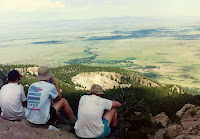
As usual hiking out of major gaps is usually the most challenging part of a trek. Up 1200 feet to Hightop with my full pack was breath-taking. I am finding my pace. Had a quick bite at a grand overlook west from rocks with two folk from NC and and family of four from FL. 

Then I am off speeding down the mountain like a bank robber attempting a getaway. Not too long thereafter I am striding through a little saddle just feeling good on the downhill and making good time when I spot and hear, simultaneously, a dark coil smack dab in the middle of the trail with about a pinky sized rattler vibrating upright, about 15 feet away. Brakes on full, I fortunately did not go headlong with my full pack even closer than I wanted to be. No camera no picture but the one at left is a pretty good likeness. I will never forget what a coiled one looks like in the middle of the trail and I spent the rest of my journey scanning the upcoming trail for that indelible image in my brain. I tried to chase him off but he only coiled tighter and stood me down. I threw some sticks around him to make it obvious to another hiker that something unusual was in the trail. I circumvented him and soon encountered some day hikers headed north and warned them so that now folk going in both direction would get a heads up. Needless to say that was the defining moment of the day, since I was just cruising over a packed dirt trail without much consideration for footfalls and later wondering what would have happened if he had not warned me soon enough. Thank God for rattlers.

I am running late now and decide to end my trip at the Pinefield hut about 11.5 m from my start, not nearly the 15 m I had planned. I will have to make up for it tomorrow. I did encounter one of the National Park Backcountry Rangers, Margot, at Simmons Gap. I had failed to secure the proper Backcountry camping permit at entry, and she graciously sorted me out and kicked in a frozen mixed berry juice box, seeing that I was a bit tired and hot. Delightful.

I arrived at the hut (for thru-hikers only) about 6:00p to find 7 people ensconced, all northbound thru-hikers save one lady on a trip like mind. Boots came off and no problems. Pack did great; I had to repurpose a long side pocket to hold my 2.5 liter hydration bladder with the tube coming out the top which worked out well. There were some primitive sights adjacent to the hut so up went my new tent. Tent set up went fine; the tent and fly open on the side making easy entry for the old man. I socialized around dinner with the hut crew, had some interesting evening conversation and went off to bed. I was a bit creeped out as I settled into my one-man with visions of coiled snakes and fantasies of a bear raid in the middle of the night. Should I go down to the hut with the other guys? I had dutifully hung my bear bag, so the exhaustion of the day overwhelmed all of that and precious sleep arrived.

So day one concluded. With 33 m to go and a meeting in Richmond in the evening on Wednesday, I have got some serious hiking to do on Tuesday. Rain in the forecast. Am I having fun?


Wednesday, June 22, 2011

New Trail: Dripping Rock (BRP) to Rockfish Gap


Date: June 21, 2011 (my first retirement hike)
Where: near Waynesboro, VA and Humpback Rocks
Weather: Mostly sunny, 60s to start, breezy, hot in the afternoon
Length: 14.4 m
Elevation change: Dripping Rock - 2940,  Humpback Mtn. - 3900, Rockfish Gap - 1900
Duration: 6.5 h including 0.5 h stop for lunch
Gear Test: REI Ventura 30 backpack, Jet Boil Stove, Salomon XA Comp 5 Trail Runners.

This is not Hank, but Bill from NY. Dropped my truck at a bombed-out filling station at Afton, walked up to the parkway and waited about 20 minutes for Bill to show. His brother just had open-heart surgery at UVA and he was taking a spin south on the parkway. Took me all the way to Dripping Rock. Angels abound! On the trail about 8:30am.

Cool start to the day but heat forecast. This is a fairly boring part of the trail with regard to views and other points of interest. Hiked under cover most of the time with filtered sunlight. Good mixture of up and down. I loaded up my smaller backpack with gear I plan to take on a longer hike as part of my training. Pack weight around 15# with stove, water filtration, food, light, 2.5 liter hydration system and an extra liter of water. I may be able to use it for an overnight trek with some ingenious packing and strapping.  Pack was comfortable, balanced, and easy to load and unload.

I plan to use my old external frame pack (somewhat passé in light of internal frame design)  for longer overnights loaded at or below 30# with the addition of tent, sleeping pad and bag and more food. It suits me.

Encountered one opportunity for views looking from east side of ridge back toward Wintergreen. Otherwise, the view was very local. I was accompanied by squirrels, chipmunks, and some other small rodent like species, as well as birds, and all varieties of flying and crawling insects. Note to self: add insect repellant to gear list. A variety of scat presented itself and I need some scat identification study to see who has been on the trail before me. Prolific and prodigious ferns.

Around 8 miles into the trip I could tell I was past Humpback Rocks since I had passed the side trail to the parking lot (access for northbound hikers), so I chose a small rock outcropping with no views for lunch. Chili Mac by Mountain House from REI. Not bad and the smaller portion (4.0 oz) was plenty. Jet Boil had water roiling in under 2 minutes. 

Up until this point I had no human contact, but I heard some gravel noise and a beckoning voice so I turned around to see a rather large hiker, basically, block out the sun and the entire mountain side. He ended up being a big teddy bear, but he could stop a bar fight before it started by just standing up. We chatted for a bit and I asked him if he were on a short or long hike. He responded: O kinda short; I'm hiking from Damascus to Harper's Ferry. Short hike? Heck, that's all of the trail in VA which is about 1/4th of the whole AT. No  puddin' hike in my book.

After that encounter I made my way over to Afton Mtn. and along the way came upon a few day hikers and some trail maintainers working on the Paul C. Wolfe Shelter. Humpback Rocks were not on my intinerary for today. I took a right at the second trail to the parking lot (access for southbound hikers) and until I came up from the east side and below the last ridge to the parkway there was not much to see. My chariot was waiting. The trail runners surpassed expectations: cool feel, lightweight, good traction, NO BLISTERS like last time with my leather Vasques. 

What's next? Maybe next week: a three-day, two-nighter north of Rockfish Gap in the SNP from Swift Run Gap back to Afton Mtn. Forty-four point eight miles with all my long distance, ultralight gear, but only if the temperature is conducive. When I came out from under cover along the parkway on Tuesday in full sun, Whew! Must have been well over 90 degrees.

Thursday, June 16, 2011

The End of a Journey: Last Day at JRT


What: Teaching math 

Where: J. R. Tucker High School, Henrico, VA
Duration: 8 years
Elevation Change: First 3 years - in the pits and pondering why I had chosen an adventure that would crush me? The last 5 years - an increasingly comfortable and gradual ascent toward the pinnacle.
When my engineering career ended in the fall of 2002; I was not old enough nor financially sound enough to discontinue working. I entered a period of discernment for what to do next. This book helped a great deal and, coupled with the counsel of many trusted friends and family members, led me to consider public education, preferably high school  as my next professional adventure. An arduous path took me through a year of uncertain job prospects but providence would have it and I ended up teaching statistics among other things at JRT in the fall of 2003.  Assigning me to teach statistics was like throwing "Brer Rabbit" into the briar patch. Why didn't anyone else want to teach it?

I survived three years of torture acclimating to the work load (I never worked that hard as an engineer) while escaping provisional status through course work needed for certification.

After year two the young lady who was teaching AP Statistics, who started the same time I did and was my closest colleague during her tenure, left and I took over that class. From that point on, each year I incrementally became more comfortable in the class room with the students, understood more the material I was teaching, and became more woven into the fabric of life at Tucker.  Teaching AP Statistics was challenging and very rewarding.  

For four years there was only one class of between 16 and 20 students; permission to take higher level math courses was granted to only a few. I taught geometry and a senior math elective consisting of one semester of statistics and one of discrete math. Then along came the VASS grant: money from private industry funneled into public education in order to increase the number of students taking math, science, and english AP classes. Money flowed to successful students and teachers and VASS provided student support in the form of exam prep sessions and teacher training and encouragement. My sense of professionalism increased by an order of magnitude. VASS encouraged Tucker to make the courses more accessible to students instead of "cream-skimming."  This year Tucker enrolled 90 students in three classes of AP Statistics; something significant had occurred! A combination of the response to the monetary incentives, opening the door wider and student enthusiasm for the course had its effect: a pinnacle year. So what's next?

I had been thinking about retiring in a year or two and several events brought the possibility and reality of this option into focus last fall. After some soul-searching, consultation with M, and financial analysis, the time seemed right. So about mid-year in went the papers.  And now the conclusion of taking that step arrives. I will miss most the interaction with the students; they are the life-blood of the experience. All else pales in comparison. A few pictures easily tell the tale.

The results of the bow tie quiz in Period 4. Everyone passed with flying colors. They also flew helicopters for their stats final project.


With C, M,  and J before graduation. With S after Senior Awards Assembly. With M and K at Prom. Walking across the stage at graduation after receiving recognition as a retiree. I got to be a marshall at the event which basically means I was the line leader, last time I did that was in elementary school. 

So I am leaving as a full-time teacher tomorrow and ending this adventure. It feels like a graceful exit. My replacement will surpass me easily. I will probably show up in the class room on occasion next year as a substitute (AP Stats only), but that's a different adventure mixed in with what I hope will be a year of some serious AT hiking. I am sooooooo excited.


Sunday, June 12, 2011

A Scouting Adventure: All the Way to Philmont

Date: June 25 to July 9, 1991 (includes travel days and sightseeing)
Where: see badge at left
Environmental Conditions: sun, rain, cold, hot, wet, dry, lush, barren, rocky, grassy, and anything else you can think of.
Length: 95 m
Elevation change: Base Camp - 6600, Baldy Town - 10,000, Baldy Mountain - 12,441, Tooth of Time - 9003, Base Camp
Duration: 11 days, 10 nights on the trail


The Scouting organization is primarily responsible for my love of the out-of-doors and, in particular, hiking and camping. I never joined the Cub Scouts, but did join, at age 11, a local Boy Scout troop in Manassas, VA. Soon after, we moved to Orange, VA, where Uncle N was the Scoutmaster and my cousins were involved in Troop 14 (one of the oldest troops in the history of scouting in America). I really took to scouting and engaged every possible opportunity from camping trips, jamborees, summer camps, to service projects. I earned my Eagle rank at age 17, and loved every minute of the experience. 

One regret I had as a youth was not going to Philmont, the national scout ranch in New Mexico. My older cousin B went and I was insanely jealous and assumed I had missed my chance.

Fast forward about 20 years; the boy is 11 and he is interested in scouting. He checks out the troop that was meeting in a church down the street and wants to join. I am ecstatic and wonder in what ways I could become involved without messing up his experience. I laid back the first year and just went on a few hikes, which did not seem to bother him. The second year, the troop adult leaders asked if I was interested in becoming an assistant scoutmaster; the boy and I discussed this and he was amenable to the idea, so I signed up. For the next 5 years we enjoyed scouting immensely due to the very active nature of this troop. "Outing is Scouting" was the mantra, so the troop planned a hiking or camping trip for each month of the school year and added a week of summer camp to that. Needless to say I was in paradise. We were invited to join the OA, which never happened for me as a youth, and I participated in Woodbadge training for adults. We were very active and both of us became steeped in learning about how to enjoy the out-of-doors in a safe, responsible way with plenty of adventure.

The culminating event of our scouting experience was our trip to Philmont. Check out the link for details about the camp. In summary Philmont is an expansive western ranch in NE New Mexico where crews of scouts (say 15 per) can follow one of about 25 prescribed treks through the mountains, valleys, and meadows of the ranch. Each day a new crew or pair of crews departs on a trek and then the next day another crew sets out, so that over the summer there is a constant stream of crews, one day apart, hiking each trek.That makes for a bunch of boys and adults having the opportunity of a lifetime.


The boy and I went with about 25 other scouts and adults from the Richmond Area; 13 in our crew. Since the theme of this blog is supposed to be hiking/camping following is a brief overview of our trek:
Day 1: Base Camp (6600) - We arrived late at night and bedded down in a wall tent on a platform in Tent City and the next morning (day 1) we organized for our trek with the assistance of a ranger, secured camp gear, shed excess personal gear, and received other training needed for a successful adventure.  My fully loaded pack weight including food and water was about 40#; I weigh 160#. 
Day 2: Road a bus up to our starting point, Ponil; we hiked a 2 m shake-down to Sioux (7200) received more ranger training (hanging bear bag, camp setup and trail discipline), and set up our first night of camping on the trail.
Day 3: 5 m to Dan Beard (7800); lovely fire road and meadow hike though temperature in the 90s; we received no trace camping instruction and participated in some wilderness challenge events; cool evening with beautiful views.
Day 4: This was our first arduous hike: 15 m to Ring Place in Val Vidal (8000) (off Philmont property); our trek was initially set for a total of 75 m but, per our request, was extended to 95 m as  we hiked past Seally Valley up to our destination; a conservation site where we took on a ditch digging project (after hiking all day) and had a very late dinner in the rain; awoke to dazzling blue skies.
Day 5: Another (now brutal) 15 miler to Rich Cabins (over 8800 ridge down to 7800); spectacular wilderness along a river bed; we had our first opportunity to rinse off near the stream, not in it, wouldn't be prudent (feet are hurting); no activities.
Day 6: Another (now punishing) 15 miler back to Ponil for resupply then to Pueblano (8200); another hot day; campfire at night with other trekkers.
Day 7: An easier hike today even with the change in elevation; 10 m to Ewell's Park and Baldy Town (10,000); caught out in a violent storm, temperature dropped 30 degrees in a few minutes with lightning, pouring rain and hail; set up camp in a lovely aspen grove; rain subsided; views amazing; cool evening.
Day 8: 8 m loop hike over Baldy Mtn (12441) to an activity site like an old west town; panning for gold, blacksmithing, then back to  Baldy Town. 360 degree panoramic views from the top on a slightly cloudy and windy day (every day is a windy day on top of Baldy); hiked above tree line in rock scrabble. We are getting pretty tough by now and acclimated to the environment.
Day 9: Now we are headed back toward base camp and we can see one of the the most prominent features of Philmont, the Tooth of Time. Each day the Tooth loomed larger beckoning us toward the end of our journey. A relatively easy descent over 10 m to Cimarron River (8500).
Day 10: Another easy 5 m to Cimarroncito over (8000) ridge to activity center with rock climbing and repelling.
Day 11: On the last stretch with 5 m over Shaeffer's Pass (10,000) to Tooth of Time (9000), which is a dry camp, so water has been carefully managed; you can only carry so much; last night on the trail; cool evening at this elevation. We can see base camp in the distance; hot down there.
SunriseSelf Portrait
Day 12: A leisurely morning, tough getting started and then the 5 m descent to Base Camp (6600); switchbacks nearly the entire way. Into camp well before lunch.  Hot. The afternoon was consumed with eating, eating, and eating, with some laundry thrown in.


We stayed two extra nights in camp, so we had the opportunity of doing some sightseeing in the area before we headed back to Denver and the flight home.


Trip reflections: wonderful father-son time, most arduous hiking experience to date, beautiful but hostile environment, great camaraderie, what the BSA organization has accomplished there is phenomenal, I was not fully prepared - boots were probably a hair too small or I tightened them too much not leaving enough room in the toe box, my little toes have never been the same since. A high adventure in so many ways. The boy and I talk about it just about every time we see each other, even 20 years later. Backpacking in the wild, as tough as it is, is a challenge I continue to enjoy more and more in retirement.